Research & Science
Northern Haiti Magnolia: A Landmark Expedition (2022)
In an extraordinary discovery, our expedition team in northern Haiti has rediscovered the Northern Haiti Magnolia (Magnolia emarginata), a tree that has been lost to science for 97 years. The team, led by Eladio Fernandez, Communications Director for Haiti National Trust, identified the tree by its distinctive alabaster flowers and uniquely shaped glossy emerald leaves. This finding offers a beacon of hope for the rewilding of Haiti’s montane forests, which have suffered extensive habitat destruction.
Expedition Overview:
The search for the Northern Haiti Magnolia took place in mid-June 2022, timed to coincide with the tree’s blooming period. The five-person HNT team set out on June 15, navigating the challenging terrain of the Massif du Nord in the North of Haiti, near the original discovery site in the now-destroyed Morne Colombo forest. The expedition faced numerous challenges, including social unrest and difficult weather conditions, but persevered in the hopes of finding this critically endangered species.
The Discovery:
On the third day of the expedition, the team spotted the magnolia in an isolated forested ravine, identifying 16 adult trees and several juvenile specimens. This finding is significant as it suggests a potentially viable population of the species. The team documented the discovery with the first-ever photographs of the species and collected herbarium samples and tissue for DNA analysis, thanks to the assistance of a local host family.
Conservation Implications:
The rediscovery of the Northern Haiti Magnolia highlights the critical importance of conserving Haiti’s remaining forest habitats. Haiti National Trust is planning a seed collection trip, aiming to establish a conservation program for this tree. Drawing on experiences from successful conservation efforts with other endemic magnolia species in Hispaniola, HNT intends to start a nursery and initiate restoration efforts with local communities.
Anne-Isabelle Bonifassi, Executive Director of Haiti National Trust, expressed optimism about the rediscovery’s implications for their ongoing conservation work: “We’ve been working hard in Haiti’s Grand Bois National Park to rewild the forests there, including Haiti’s other endemic magnolia species Magnola ekamnii, and we are excited to apply that work to help us preserve another beautiful, iconic and endemic magnolia.”
Collaborative Efforts:
This expedition was supported by Re:wild, which has been actively working to protect and restore Caribbean islands, including the creation of Haiti’s first-ever private reserve in the Grand Bois ecosystem. Jenny Daltry, Caribbean Alliance Director for Re:wild, emphasized the broader significance of this rediscovery for biodiversity conservation in the region: “Biodiversity loss is a serious threat to people and the environment all over the Caribbean region. That’s why Re:wild and Fauna & Flora International have combined forces to raise awareness and support to protect and restore Caribbean Islands—including Hispaniola.”
Support and Acknowledgments & Need for Funding:
This expedition was made possible by the generous support of Asociación Popular de Ahorros y Prestamos (APAP), Fundación Progressio, and Sunrise Airways. Their contributions have been instrumental in enabling this historic rediscovery and the continued efforts to conserve Haiti’s unique biodiversity.
As Haiti faces the rapid decline of its forests and the loss of precious endemic and native species, funding is crucial for Haiti National Trust, a leading organization in biodiversity conservation in Haiti. Financial support is needed not only for more expeditions like this one but also for restoration projects that can prevent these species from becoming extinct. As of 2024, Haiti National Trust has yet to secure the necessary funds to establish in-situ nurseries for propagating, protecting, and restoring the Northern Haiti Magnolia.
Visit our news article about this discovery and what the international media The Guardian said about it!
The rediscovery of the Northern Haiti Magnolia is a significant milestone in our mission to rewild Haiti. It reaffirms the resilience of Haiti’s natural heritage and inspires us to continue our efforts to preserve and restore these vital ecosystems for future generations. If you wish to contribute and help us save this species, please consider making a donation.
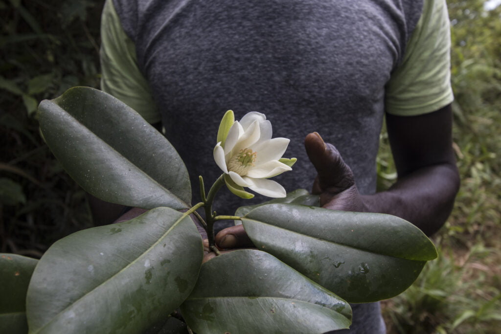
Northern Haiti magnolia (Magnolia emarginata) photographed June 19, 2022. It was the first time the magnolia tree had been documented by scientists in nearly 100 years and the first time this magnolia species has been photographed - Eladio Fernandez (Haiti National Trust)
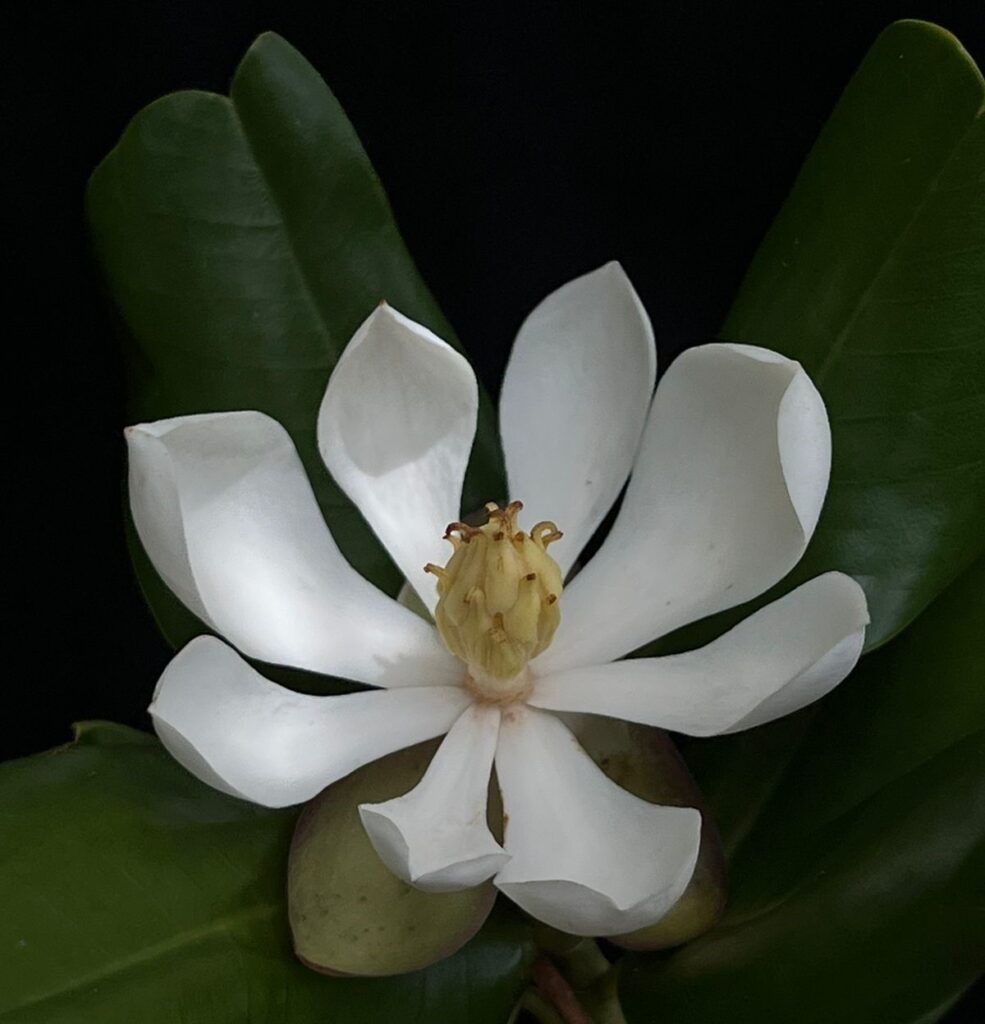
Northern Haiti magnolia (Magnolia emarginata) June 2022 - Eladio Fernandez (Haiti National Trust)
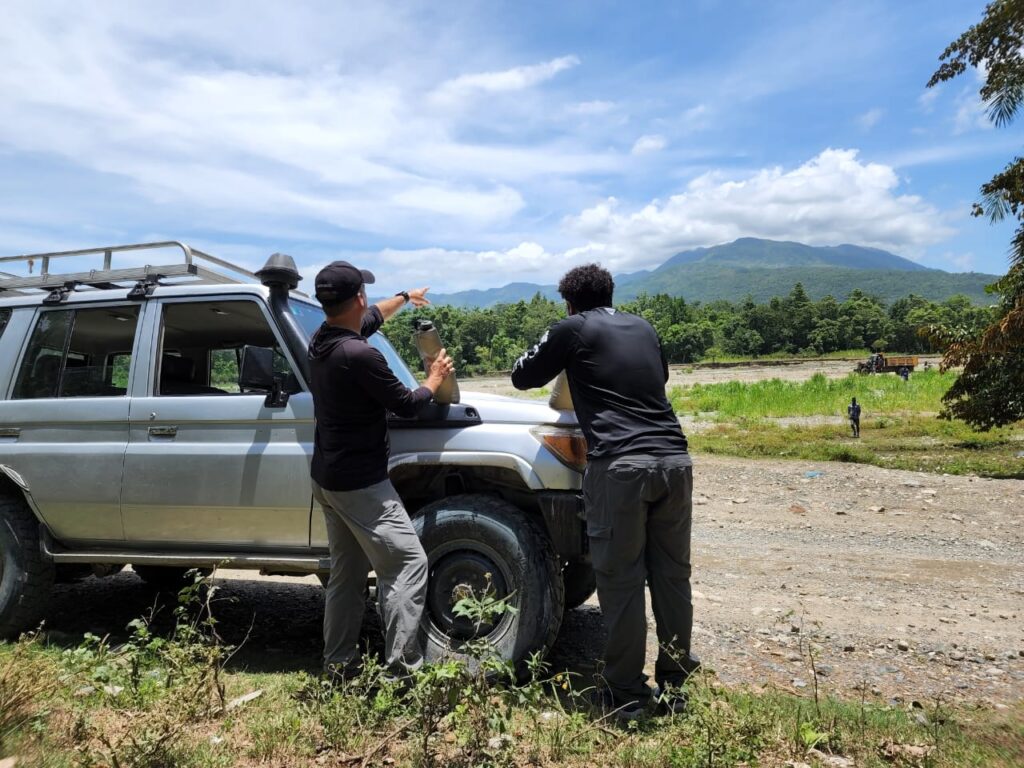
The team in search for the Northern Haiti Magnolia - David Stephenson (Haiti National Trust)
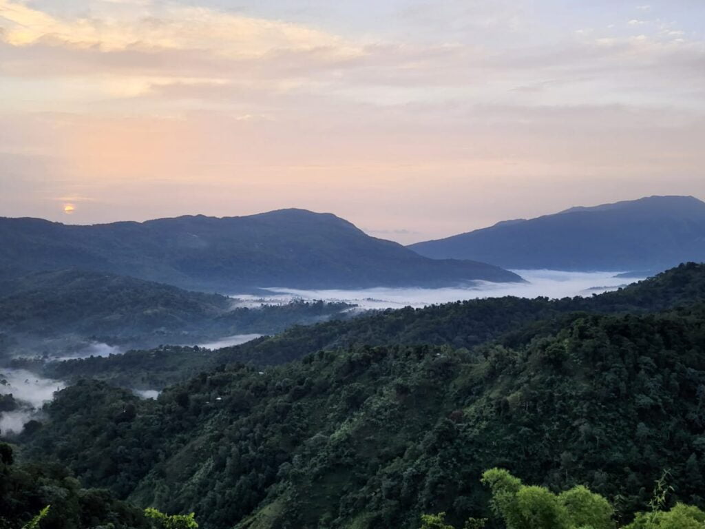
Northern Haiti mountains, in search for the Magnolia - David Stephenson (Haiti National Trust)
Aerial Census of the American Flamingo in Haiti (2024)
In response to concerning trends in the destruction of habitat for American Flamingos (Phoenicopterus ruber) on Hispaniola, conservation efforts are being intensified. Despite being labeled as Least Concern (LC) on the IUCN Red List, recent evaluations point to significant declines in breeding colonies and habitat quality.
Context:
Since the arrival of Spanish and French settlers in 1781, American Flamingos have been a familiar sight on the island, once deemed locally abundant. However, the landscape has undergone notable changes, primarily due to habitat degradation driven by human activities. In Haiti, these graceful birds are non-breeding residents. The last breeding colony was observed in Haiti in 1928.
Flamingos have previously been spotted in various coastal mangrove lagoons, including those near Liberté Bay, Grande Saline, Gonaïves, Étang Saumâtre, and offshore islands like Île de la Gonâve, Île-à-Vache, and Île de la Tortue. However, these critical habitats are under threats like mangrove deforestation, urban expansion, rising sea levels, and illegal poaching.
The Aerial Census:
In a proactive move to address these concerns, Haiti National Trust conducted in February 2024, an aerial survey to assess the flamingo population across Haiti. This survey was conducted simultaneously in the Dominican Republic and Turks and Caicos between February 19th and 27th, aiming to gather comprehensive data to advocate for a change in the flamingos’ protection status by comparing current findings with historical data. Our team selected sites in Haiti known to host flamingos and used aerial survey methods to count the birds at each site. Due to bad weather and logistical constraints, not all locations were surveyed.
The Results:
In total, the study counted an estimated 1,333 flamingos during the survey, which is the average for Haiti, with populations varying from 300 to 1,500 flamingos annually and peaking at 3,000 flamingos during the winter months. The mangroves of L’Estère (1,000 flamingos) and Lac Azuei (229 flamingos) remain the most important flamingo sites in Haiti. The results are encouraging, considering that our estimate in L’Estère matches a study conducted 24 years ago. We can also confirm that flamingos can revisit sites previously abandoned and occur in new sites not previously known.
For more details on this survey and findings, download the Novitates Caribaea published article (July 2024) written by authors Joel Timyan (Director of Conservation at HNT), Anne-Isabelle Bonifassi (Executive Director at HNT) and Jean-Mary Exantus, PhD (renowned Haitian ornithologist).
Funding & Support:
Funding for this aerial survey has been generously provided by a private donor. However, broader support from the conservation community is essential to sustain efforts aimed at protecting Haiti’s flamingos. Concerned individuals can make a tangible difference in ensuring the survival of these majestic birds and the ecosystems they inhabit in Haiti. If you wish to contribute, consider a donation. The data collected through these surveys are crucial in focusing our conservation efforts in the right places, ensuring the future of the American Flamingo in Haiti.
Acknowledgements:
We extend our heartfelt gratitude to Philippe Bayard, Sandro Masucci, Mathias Perry, Jean Mary Exantus, Pierre Michel Jean, and Bernard Delatour. Together, through collaborative endeavors and widespread support, we can strive towards securing a sustainable future for these iconic birds and the biodiversity they represent.
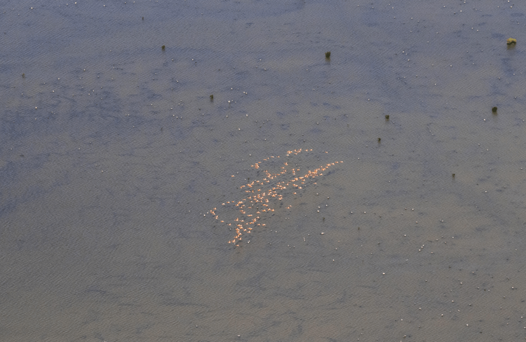
Aerial view of a group of flamingos in L′Estere - Pierre Michel Jean (Haiti National Trust)
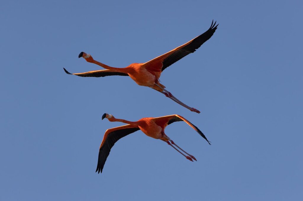
American Flamingo (Phoenicopterus ruber) flying over Hispaniola - Eladio Fernandez (Haiti National Trust)
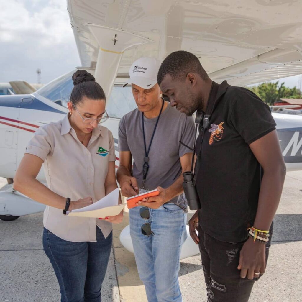
The survey team getting ready to fly (Feb 2024)
Decoding primary forest changes in Haiti and the Dominican Republic using Landsat time series (2025)
Abstract:
Forest loss has greatly reduced habitats and threatened Earth’s biodiversity. Primary forest (PF) has an irreplaceable role in supporting biodiversity compared with secondary forest (SF). Therefore, distinguishing PF and SF using remote sensing observations is critical for evaluating the impact of forest loss on biodiversity. However, continuous monitoring of PF loss through remote sensing time series observations remains largely unexplored, particularly in developing tropical regions. In this study, we used the COLD algorithm (COntinuous monitoring of Land Disturbance) and Landsat time series data to quantify PF loss on the island of Hispaniola, comprising Haiti and the Dominican Republic, from 1996 to 2022. We considered the resilience of PF to different disturbance agents and identified the primary drivers of PF loss in Hispaniola through a sample-based approach. Accuracy assessment based on the stratified random sample shows that the overall accuracy of land cover classification is 80.5% (±5.2%) [95% confidence interval]. The user’s, producer’s, and overall accuracies of PF loss detection are 68.8% (±9.3%), 73.6% (±38%), and 99.4% (±0.5%), respectively. Map-based analysis reveals a more pronounced decline in PF coverage in Haiti (0.75% to 0.44% at 324 ha/year) compared to the Dominican Republic (7.14% to 5.67% at 2,704 ha/year), with substantial PF loss occurring both inside and outside protected areas. Furthermore, Haiti exhibits a higher degree of PF fragmentation, characterized by smaller and fewer PF patches, than the Dominican Republic, posing significant challenges for biodiversity conservation. The remaining PFs are found on steeper slopes in both Haiti and the Dominican Republic, suggesting that flatter, more accessible areas are more vulnerable to PF loss. Fire, tree-cutting, and hurricanes were identified as the primary drivers of PF loss, accounting for 65.7%, 20.9%, and 9.0% of the PF loss area in Hispaniola, respectively. These findings underscore the urgent need for conservation policies to protect remaining PF in Hispaniola, particularly in Haiti.
Conclusion:
Distinguishing PF and SF using remote sensing observations is critical for evaluating the impact of forest loss on biodiversity, which is rarely done in tropical regions. Our study used dense Landsat time series and the COLD algorithm to map annual PF changes in Haiti and the Dominican Republic from 1996 to 2022. We successfully distinguished PF and SF with an overall accuracy of 80.5% (±5.2%) for the land cover classification. The major conclusions include: (1) From 1996 to 2022, both Haiti and the Dominican Republic experienced rapid PF loss, inside and outside protected areas, indicating that those areas are ineffective. Map-based results indicate that Haiti’s PF decreased from 0.75% to 0.44% and the Dominican Republic’s PF decreased from 7.14% to 5.67%. Haiti has a higher proportion of PF directly converted to nonforest surface. (2) Haiti exhibits significantly greater PF fragmentation compared to the Dominican Republic. This higher degree of fragmentation further threatens Haiti’s remaining PF and its associated biodiversity. (3) Slope plays a crucial role in the PF loss. PF in regions with steeper slopes tends to be less accessible to humans, thus experiencing less PF loss. (4) The major driver of PF loss in Hispaniola is fire. This is followed by tree-cutting, hurricanes, and landslides. The generated land cover map can be valuable in guiding the PF and biodiversity conservation efforts. With training data collected from other locations, this approach could be applied to other regions and at larger scales.
Access the article: View or download the full article here.
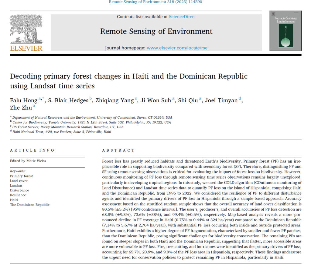
https://doi.org/10.1016/j.rse.2024.114590
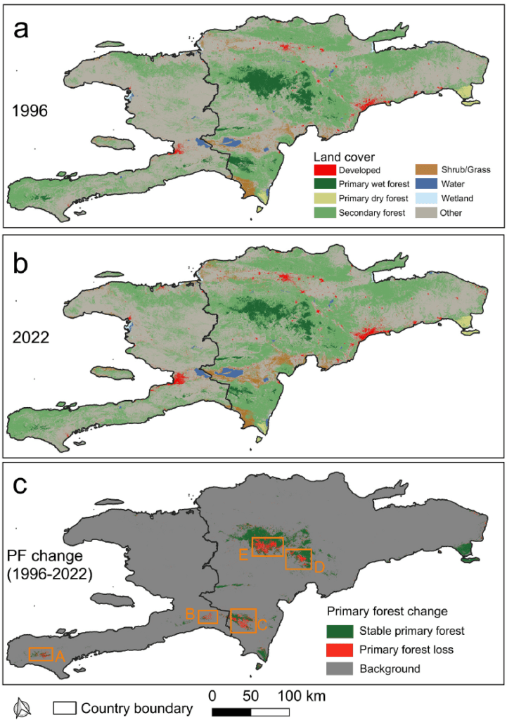
Land cover maps of Hispaniola in 1996 (a) and 2022 (b). Subplot (c) shows the primary forest (PF) change information.

